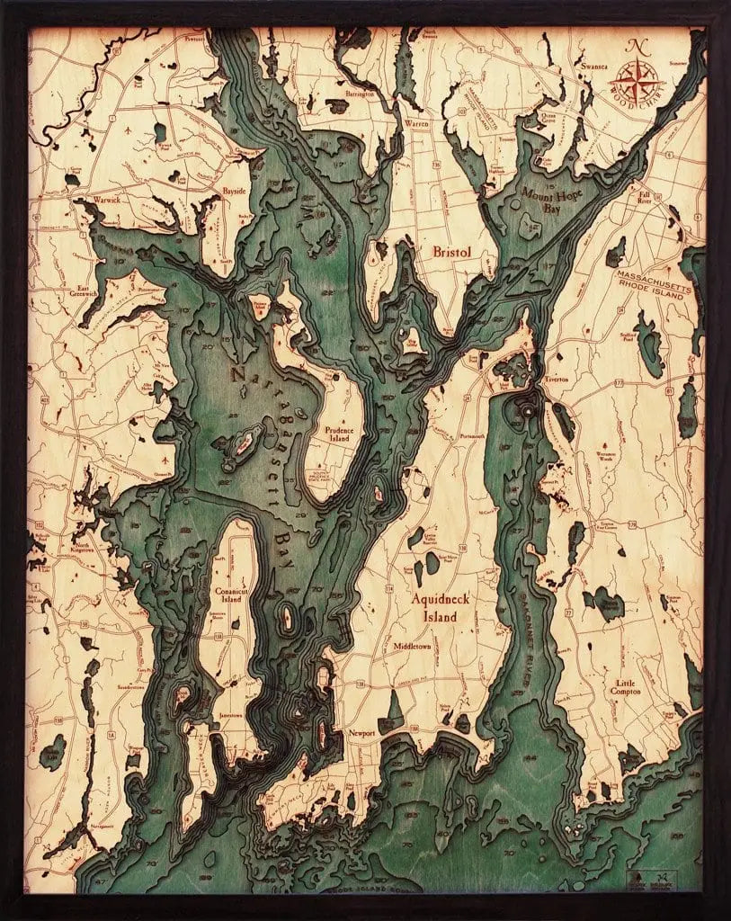


3D Nautical Wood Chart of Narragansett Bay, RI - Large
Wood Chart's beautiful map of Narragansett Bay, Rhode Island. A 3-D nautical wood map featuring Narragansett Bay and Newport, Rhode Island. 24 1/2" x 31" x 2"
Narragansett Bay, on the north side of Rhode Island Sound, forms New England's largest estuary, which functions as an expansive natural harbor, and includes a small archipelago. Small parts of it extend into Massachusetts.
Points of Interest:
Aquidneck Island, Conanicut Island, Prudence Island, Providence River, Rhode Island Sound, Mount Hope Bay, and the Sakonnet River.
Our wood charts are made from Baltic birch and have a solid wood frame. They come ready to hang, and we will provide free shipping within the continental United States.
**Some wood charts are not currently in stock at our store; if you are placing an order for a Wood Chart that is time sensitive, please give us a call at 401-849-5680 to find out if we have it in stock or whether it needs to be ordered. Thank you.